Pauatahanui -
description of the Inlet
| Pauatahanui - |
|||
|
|
Pauatahanui Inlet is an east-west running arm of Porirua Harbour, 30 kms north of Wellington, New Zealand. Green hills and low cliffs encircle the sheltered waters and mud flats. It is 3.5 kms long, 2 kms at its widest and the shoreline is 13 kms. The valley of the Inlet has been in-filled by sands and silts eroded from the surrounding hills. Stream mouths at the east and north are flanked by salt marsh. |
 |
|
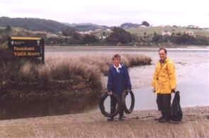
Maori have lived on its shores for at least 500 years. In the past it has been a favourite site for shell fish gathering, hand line fishing and netting. Maori also are believed to have hunted moa and kiwi in the coastal forests, but little remains of the original vegetation. Today two thirds of the catchment is grassland, mainly sheep farms. In the last 15 years berry crops, apples, plant nurseries, and hot house crops have crept into sheltered stream valleys. The western end of the Inlet at Paremata, Mana and Plimmerton have been holiday and dormitory suburbs for 100 years. Since the early 1970s the Whitby development has progressively brought housing subdivision along the southern side of the Inlet. Shallow, sheltered waters are ideal for small yachts and board sailing. Fishing and shellfish gathering have traditionally been an attraction, but fish and cockle stocks are much depleted. Currently shellfish collectors are advised to not collect shellfish because of enterococcal pollution. |
||
 The largest of these is a wildlife reserve which is conserved and developed
by local branches of the
The largest of these is a wildlife reserve which is conserved and developed
by local branches of the